Arctic Sea Ice at Minimum Extent - 2026
By LT Jared Doris, US Navy
U.S. National Ice Center
September 30, 2026
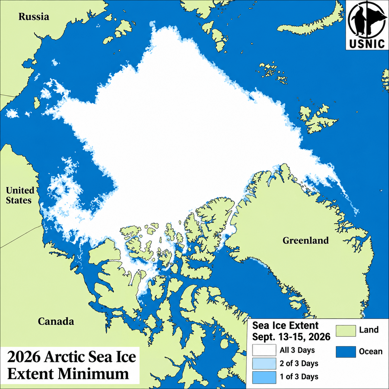
The U.S. National Ice Center (USNIC) has determined that the 2026 Arctic sea ice minimum occurred in mid-September, with a minimum three-day average extent of 4.77 million square kilometers centered on September 14th.
The determination is based on daily sea ice extent from the Multisensor Analyzed Sea Ice Extent (MASIE) product, which is derived from USNIC’s Interactive Multisensor Snow and Ice Mapping System (IMS) analysis and hosted by the National Snow and Ice Data Center (NSIDC). USNIC identifies the annual minimum using a three-day running average of daily MASIE extent to account for short-term variability in the analyzed sea ice edge.
The USNIC has calculated the Arctic sea ice minimum and maximum in this current method since 2006. The 2026 minimum extent of 4,773,814 square kilometers was approximately 275,000 square kilometers, or 6.1 percent, above the 2006–2026 average minimum of 4.50 million square kilometers. The three-day minimum period was centered on September 14th, approximately three days earlier than the 2006–2026 average minimum date of September 17th.
For comparison, NSIDC announced on September 23rd that its Sea Ice Index indicated the 2026 Arctic minimum occurred on September 12th at 4.60 million square kilometers, ranking 10th lowest in its nearly 48-year satellite record. The USNIC/MASIE estimate was approximately 174,000 square kilometers, or 3.8 percent, greater than the NSIDC Sea Ice Index estimate.
The difference reflects the distinct data and methodologies used by the two products. The NSIDC Sea Ice Index derives sea ice extent from satellite passive-microwave observations at a nominal 25-kilometer resolution using a 15-percent sea ice concentration threshold. MASIE instead derives daily extent from USNIC's higher-resolution IMS analysis, which integrates multiple satellite and operational data sources with analyst interpretation to determine the presence of sea ice.
The annual minimum marks the transition from the Arctic melt season into autumn freeze-up and provides a reference point for continued operational monitoring of Arctic sea ice through the winter growth season.
To access daily products, weekly products, archival data and much more of USNIC data in various formats, visit the USNIC webpage at: https://usicecenter.gov/Products
For more information, please contact:
National Ice Center
Command Duty Officer
Voice: (301) 943-6977
E-mail: nic.cdo@noaa.gov
Twitter: @usnatice
Facebook: @usnatice
The U.S. National Ice Center is a tri-agency center operated by the Navy, NOAA, and Coast Guard and provides global to tactical scale ice and snow products, ice forecasting, and related environmental intelligence services for the United States government.
