Mid-Atlantic Products
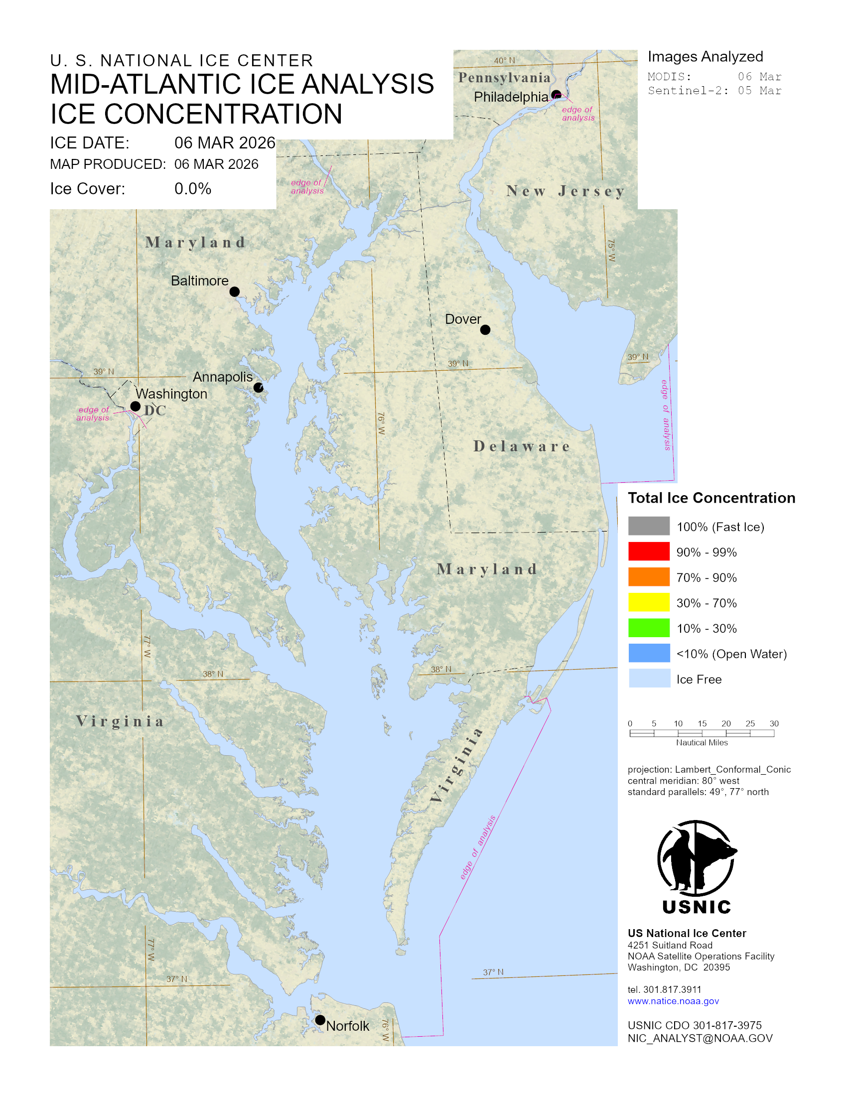
The U.S. National Ice Center (USNIC) monitors and records ice conditions within the Mid-Atlantic coastal region. A main area of recurring seasonal ice (may have years of no ice) is the Chesapeake, Potomac and Delaware Bay region. When ice is present, USNIC produces an ice chart, weekly outlook and associated support files.
Area
Description
Display / Format
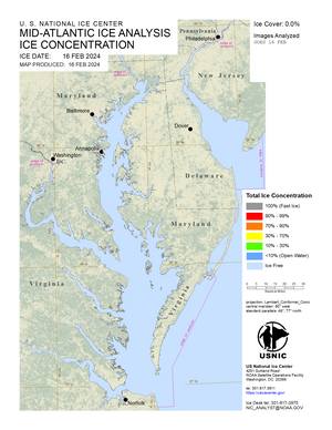
Mid Atlantic Ice Chart
A periodic ice chart that displays ice conditions based off the Mid Atlantic analysis. An ice chart is produced when suitable satellite coverage over the region and/or reliable observations are reported. Ice coverage is detailed by color coded ice concentrations.