Arctic Seasonal Products
The U.S. National Ice Center (USNIC) has 2 recurring annual Arctic products: Sea Routes and North American Ice Service (NAIS) 30-Day Outlooks. Sea Routes are produced June through September and Outlooks June to December. For more information visit Product Catalog.
Area
Description
Display / Format
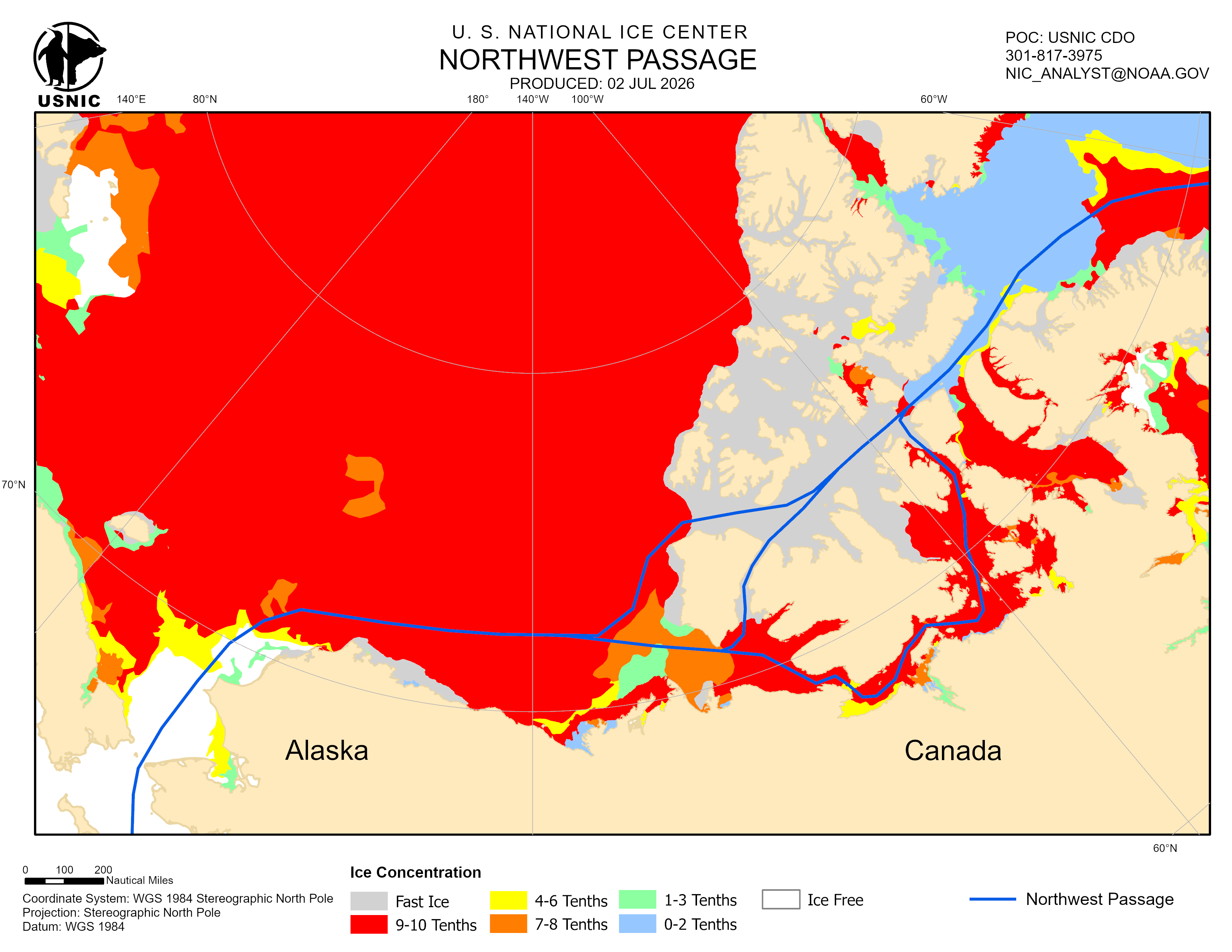
Northwest Passage
Seasonal chart completed weekly (Friday) during the Arctic melt season. The Northwest passage concentrates on transit from Pacific to Atlantic Ocean via the Arctic through Bering Strait into the Canadian Archipelago and exiting through the Labrador Sea. This chart shows ice concentration and best path based on ice conditions.
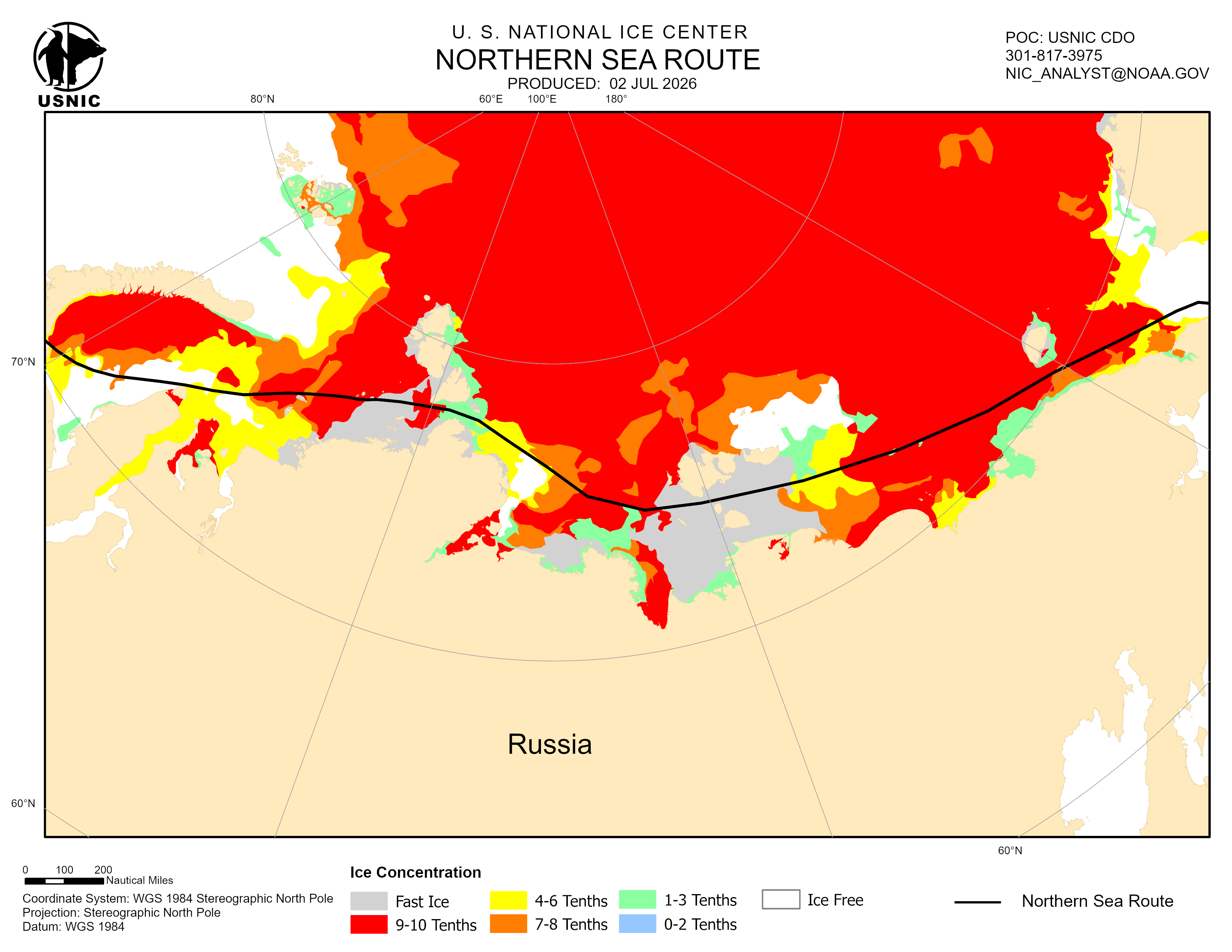
Northern Sea Route
Seasonal chart completed weekly (Friday) during the Arctic melt season. The Northern Sea Route concentrates on transit from Pacific to Atlantic Ocean via the Arctic through Bering Strait into the Laptev Sea and exiting through the Barents Sea. This chart shows ice concentration and best path based on ice conditions.
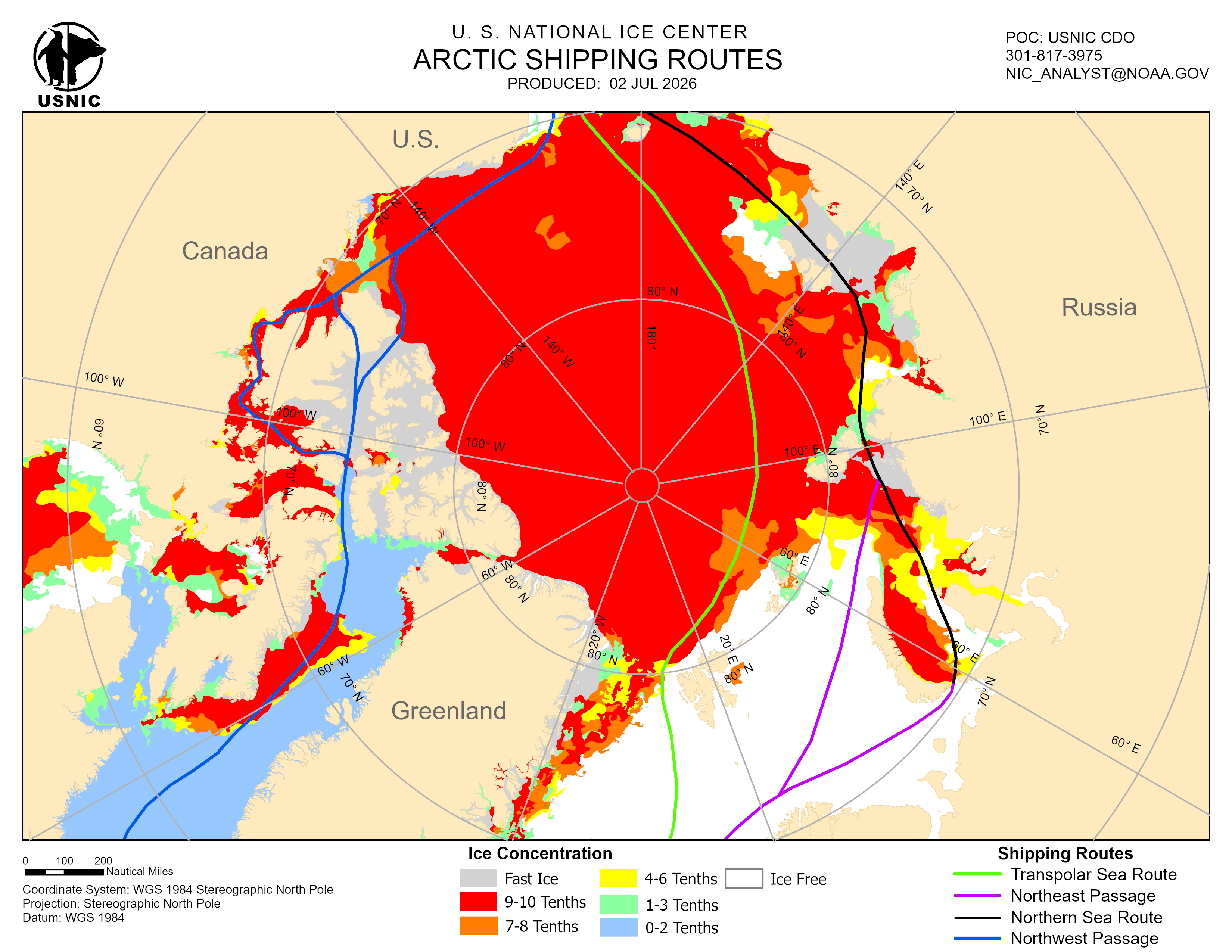
Arctic Sea Routes
Seasonal chart completed weekly (Friday) during the Arctic melt season. The Arctic Sea Routes chart covers the entire Arctic and displays the sea route transits from the Pacific and Atlantic. The chart displays ice conditions based on concentration with the overlaid shipping routes. This product is only produced when all four Arctic Shipping Routers routes are nearing navigability.
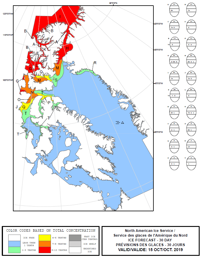
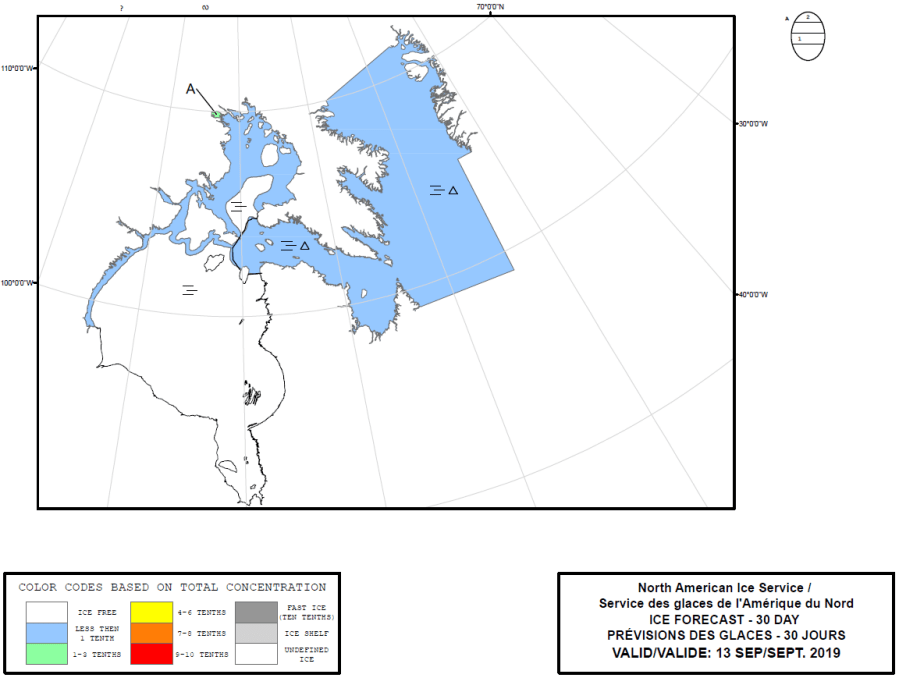
NAIS East 30-Day Outlook
The East 30-Day outlook covers the eastern portion of North American waters to include the Eastern Canadian Archipelago, Baffin Bay, Davis Strait, Foxe Basin, and Northern Labrador Sea.
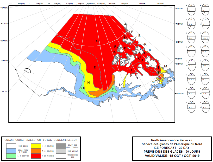
NAIS West 30-Day Outlook
The West 30-Day outlook covers the western portion of North American waters to include the High Arctic region, Western Canadian Archipelago, Beaufort Sea, and Chukchi Sea.