Mid-Atlantic Ice Chart
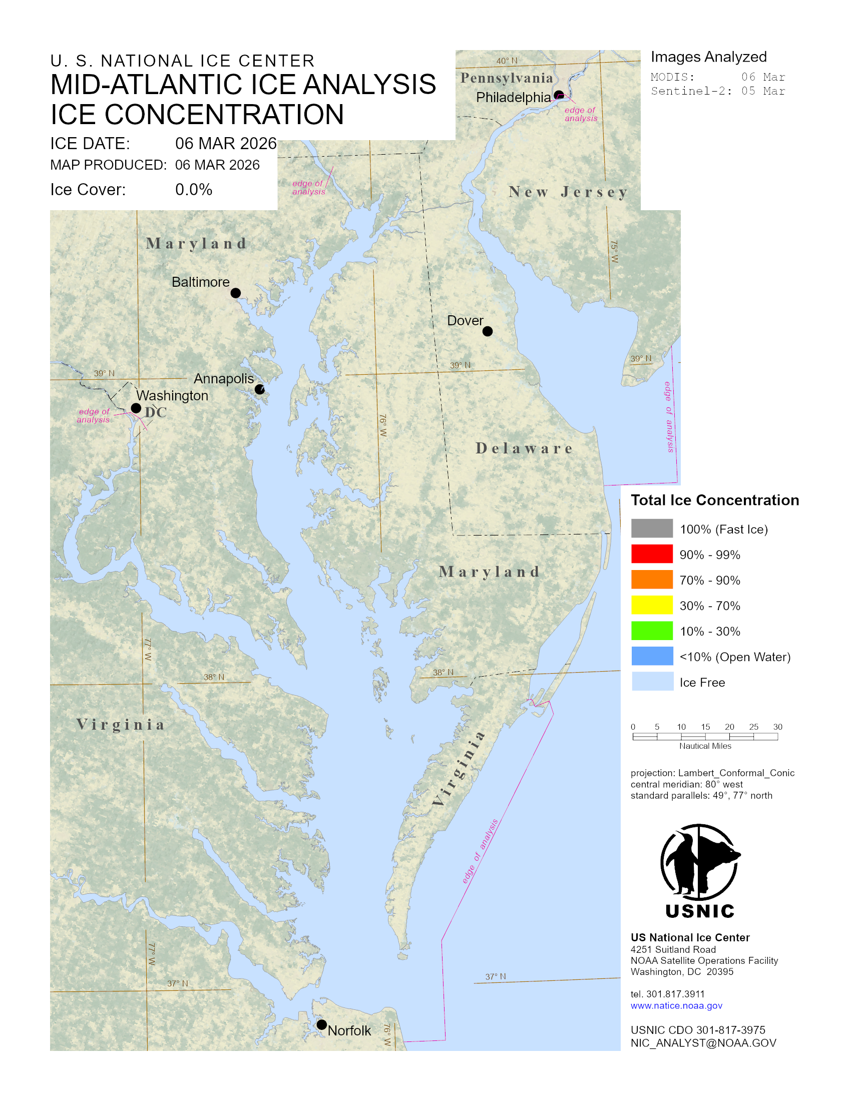
When ice is present within the Mid-Atlantic region of the U.S., the U.S. National Ice Center conducts an ice analysis of the area and produce an ice chart detailing ice conditions. Also with ice presence, a weekly outlook is produced that details the upcoming weather conditions and its affect on ice conditions.
Area
Description
Display / Format
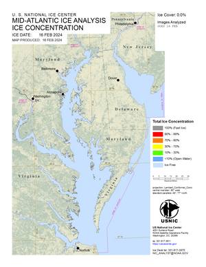
Mid Atlantic Ice Chart
A periodic ice chart that displays ice conditions based off the Mid Atlantic analysis. An ice chart is produced when suitable satellite coverage over the region and/or reliable observations are reported. Ice coverage is detailed by color coded ice concentrations.