Catalog Overview
Arctic Region
Antarctic Region
Great Lakes Region
Mid-Atlantic Region
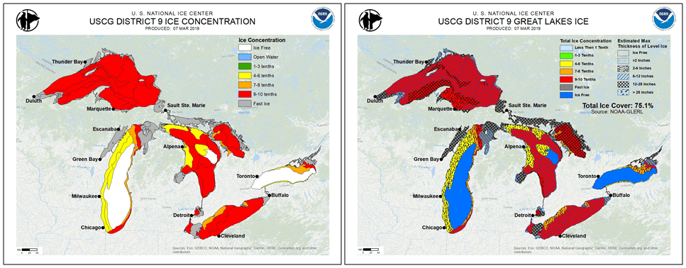
U.S. Coast Guard District 9 Ice Charts
Product:
USCG
D9 Ice Concentration Chart
USCG D9 Ice Thickness Chart
USCG D9 Ice Concentration / Thickness Chart
Description: Three custom graphics produced in support of USCG District 9.
1. Ice Concentration - shows ice concentration for the specified day in the Great Lakes from ice free to fast ice.
2. Ice Thickness - shows estimated maximum ice thickness for the specified day in the Great Lakes from ice free to greater than 28 inches
3. Ice Concentration and Thickness - shows both the ice concentration and estimated max thickness for the specified day in the Great Lakes
Coverage Area: Great Lakes
Format: PNG
Periodicity: Twice weekly, on Tuesday and Thursday during the Great Lakes ice season
Dissemination: USNIC Website