Catalog Overview
Arctic Region
Antarctic Region
Great Lakes Region
Mid-Atlantic Region
Arctic Sea Route Charts
Products:
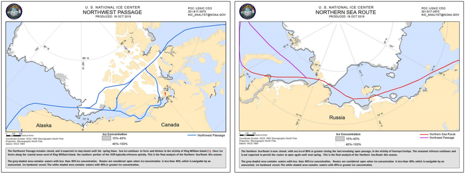
Northwest Passage (NWP) Chart
Northern Sea Route (NSR) Chart
Arctic Shipping Routes (ASR) Chart
Description: A graphical representation of the ice edge and area of 40% or greater ice concentration for the NWP and the NSR; a write-up of ice conditions is included in the product
Coverage Area:
NWP: 170E to 60W north of 60N
NSR: 40E to 160W north of 70N
ASR: entire Arctic region
Coverage Area: Arctic and subarctic waters
Format: PNG
Periodicity: Weekly on Friday; approximately from late July to mid-October
Dissemination: USNIC website, CTG 80.7 Portal, NEP-Oc IC Portal