Catalog Overview
Arctic Region
Antarctic Region
Great Lakes Region
Mid-Atlantic Region
Arctic Text Products
Products:
North ASCII
MIZ
Ice Extent
SPAROS
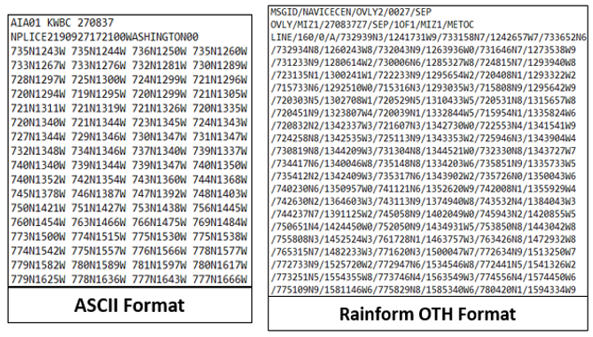
Description: ASCII text files with ice boundary lines identified by latitude and longitude pair sequence
ASCII Format - contains ice lines at the ice edge and pack ice (ice concentration
80% and greater) boundaries
1. North ASCII - Shows the daily Ice Edge data to the nearest 1/10th of a degree
Rainform OTH - a text format with a DoD defined
header and body that latitude and longitude pairs follow
1. MIZ - outlines ice edge and marginal ice zone (concentration up to 80%) boundaries within
the Arctic
2. Ice Extent - outlines ice edge boundary
3a. SPAROSPAC1 - outlines the ice edge within the North Pacific Ocean
3b. SPAROSPAC2 - outlines the pack ice boundary (concentration at 80% or greater) within the
North Pacific Ocean
3c. SPAROSPAC3 - outlines the 48-hour forecast ice edge within the North Pacific Ocean
3d. SPAROSLANT1 - outlines the ice edge within the North Atlantic Ocean
3e. SPAROSLANT2 - outlines the pack ice boundary (concentration at 80% or greater) within
the North Atlantic Ocean
3f. SPAROSLANT3 - outlines the 48-hour forecast ice edge within the North Atlantic Ocean
Coverage Area: Arctic and subarctic waters
Format: ASCII
Periodicity: Daily
Dissemination: USNIC website, CTG 80.7 Portal, NEP-Oc IC Portal