Catalog Overview
Arctic Region
Antarctic Region
Great Lakes Region
Mid-Atlantic Region
Arctic Trivariate Charts
Products:
Trivariate Compendium Year Charts
Trivariate Single Year Charts
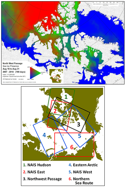
Description: Trivariate Sea Ice Presence products are derived from
USNIC
archived data to provide a characterization of analyzed sea ice conditions in the polar regions. Colors indicate
that only pack ice (red), marginal ice zone (green), or ice free (blue) conditions were present.
Compendium Year - data is comprised of Daily Sea Ice information for the stated
period for every year from 2007 to the year stated
Single Year - data is comprised of the Daily Sea Ice information for the stated single year
Coverage Area: The Arctic is divided into six regions for Compendium and Single Year products:
1.
NAIS Hudson - covers Hudson Bay, Foxe
Strait, Davis Strait and Labrador coastal regions
2. NAIS East - covers Baffin Bay and Foxe Basin regions
3. Northwest Passage - covers Chukchi/Beaufort Seas, Canadian Archipelago, Baffin Bay, and Foxe Basin
4. Eastern Arctic - covers Greenland, Barents, and Kara Seas
5. NAIS West - covers Canadian Archipelago, Beaufort/Chukchi Seas and northern Arctic regions
6. Northern Sea Route - covers Chukchi, East Siberian, Laptev, and Kara Seas
Format: PDF, PNG
Periodicity: Twice a month, on the 16th and last day of the month
Dissemination: USNIC website