Catalog Overview
Arctic Region
Antarctic Region
Great Lakes Region
Mid-Atlantic Region
Antarctic Daily GIS Shapefiles
Product:
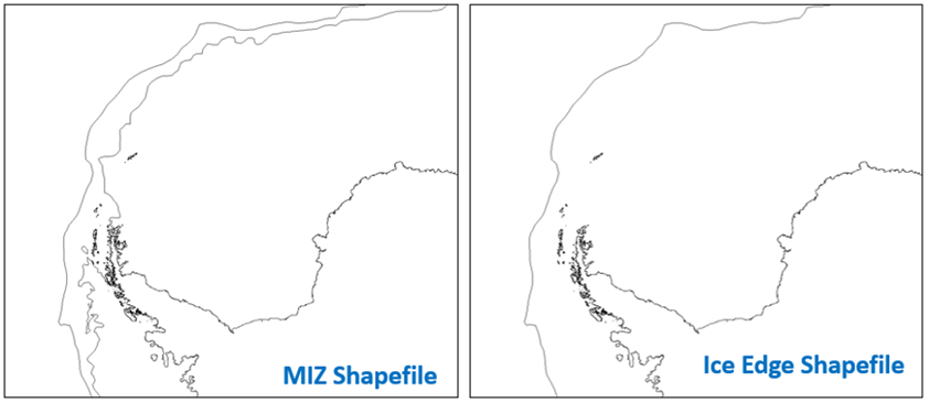
MIZ Shapefile
Ice Edge Shapefile
Description: A GIS format that contains analyzed ice lines and ice concentration data derived from
USNIC daily ice analysis. Two GIS shapefiles created:
1. MIZ Shapefile - contains ice lines at the ice edge and pack ice (ice concentration 80% and greater) boundaries
2. Ice Edge Shapefile - contains an ice line that separates ice from no ice
Coverage Area: Antarctic waters
Format: ZIP compressed, contains: SHP, DBF, SHX, PRJ, XML
Periodicity: Daily
Dissemination: USNIC website, CTG 80.7 Portal, NEP-Oc IC Portal