Catalog Overview
Arctic Region
Antarctic Region
Great Lakes Region
Mid-Atlantic Region
Antarctic Peninsula Charts
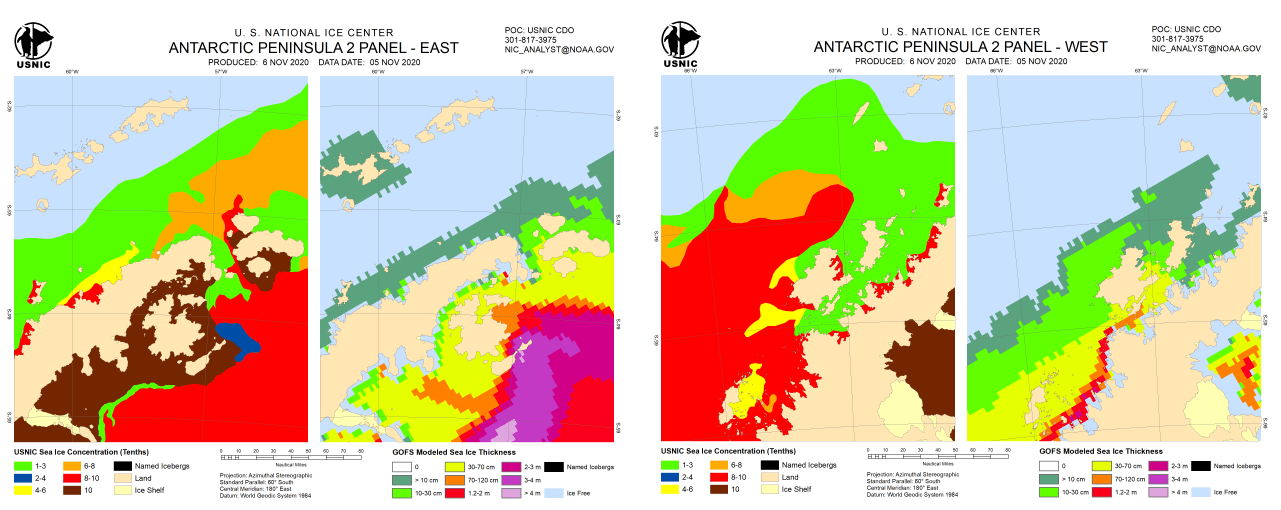
Product:
Antarctic Peninsula 2 Panel - East
Antarctic Peninsula 2 Panel - West
Description: Provide sea ice conditions in a 2 panel graphic for the east and west Antarctic Peninsula.
Left panel - displays ice concentrations (in tenths)
Right panel - displays the estimated ice thickness based off GOFS data
Coverage Area: Antarctic Peninsula
Format: PNG
Periodicity: Weekly on Thursday, from November until the end of March
Dissemination: Email