Catalog Overview
Arctic Region
Antarctic Region
Great Lakes Region
Mid-Atlantic Region
Great Lakes Ice Charts
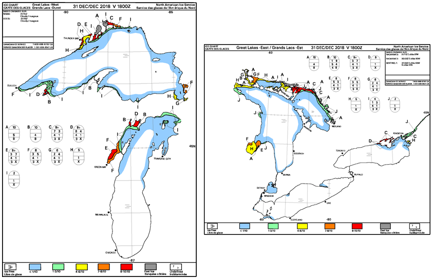
Product:
Great Lakes East Composite Chart
Great Lakes West Composite Chart
Description: A graphical representation of the current ice conditions, classified by ice concentration, stage of development and ice floe size. This product is created in conjunction with CIS as a NAIS product. Charts are produced in color and black and white.
Coverage Area:
Great Lakes East - covers Lakes Huron, Erie, and Ontario
Great Lakes West - covers Lakes Superior and Michigan
Format: GIF
Periodicity: Daily
Dissemination: USNIC Website, CIS Website